Multidimensional remote sensing based mapping of tropical forests and their dynamics
Loïc Dutrieux

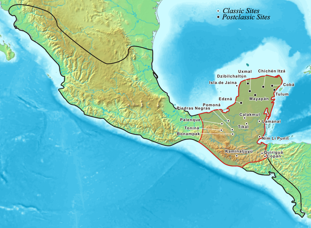
Mesoamerica - 950 A.D.
Credit: Office of Biological and Environmental Research of the U.S. Department of Energy Office of Science.
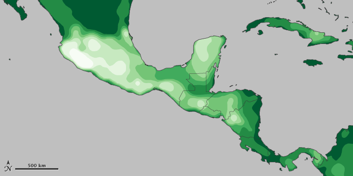
Myers et al. (2010) Biodiversity hotspots for conservation priorities. Nature
How can we keep an eye on these important forest resources?


Credit: Airbus Defence and Space


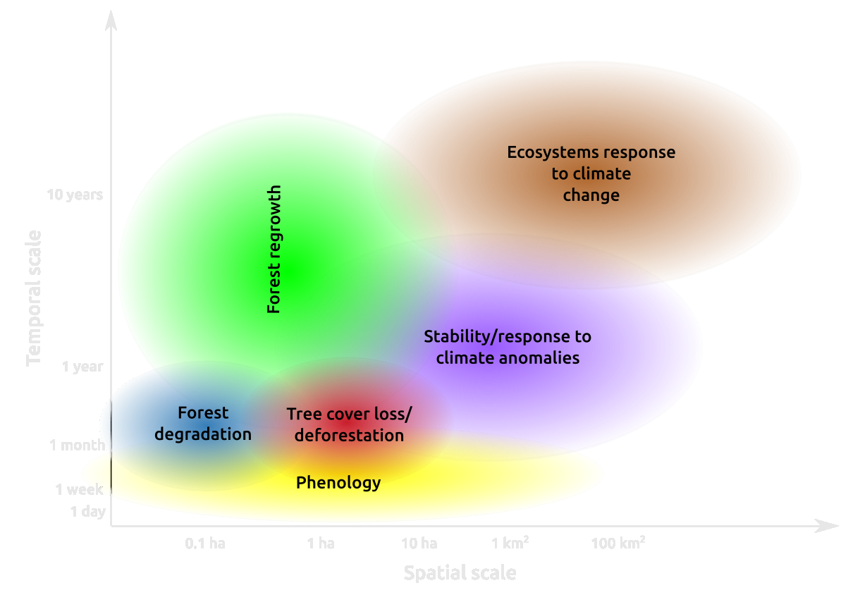
There is a lot of data
Overall objectives
- Take advantage of this large data diversity to map forest state and dynamics
- Combine ground based ecological measurements with satellite data
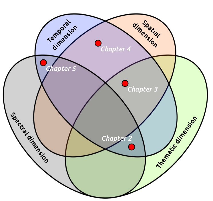
Chapter 1: Mapping forest attributes
Chapter 1: Mapping forest attributes
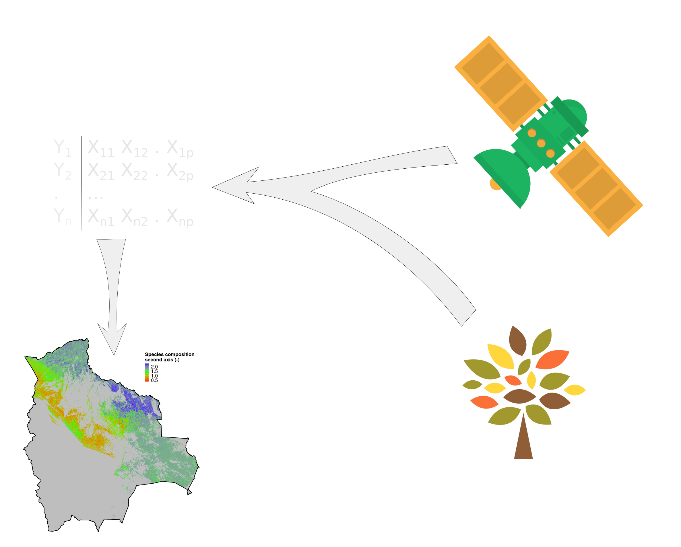
Chapter 1: Mapping forest attributes
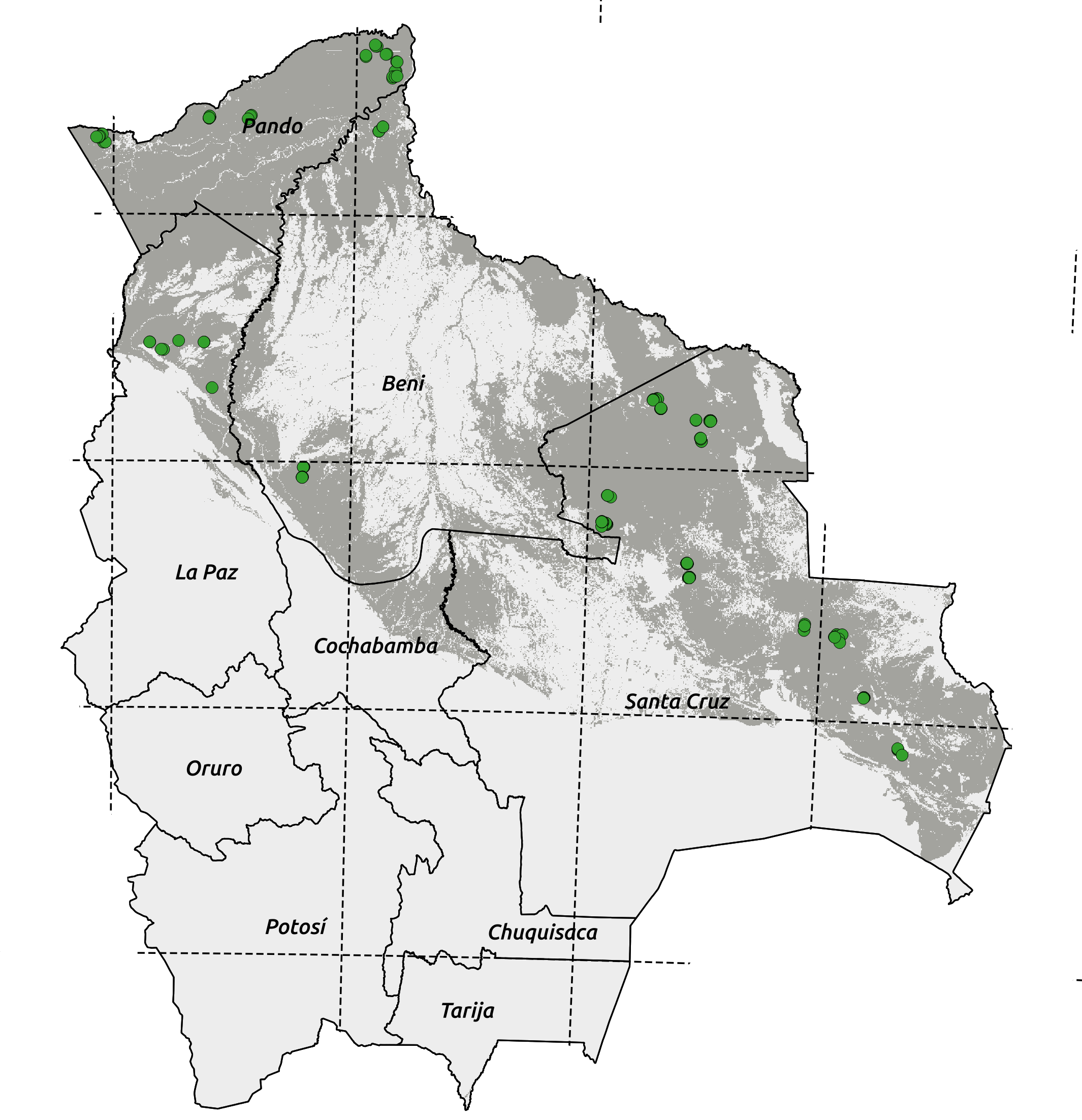
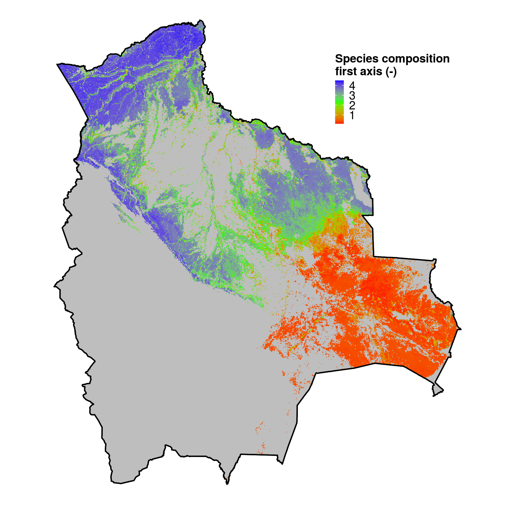 Species diversity |
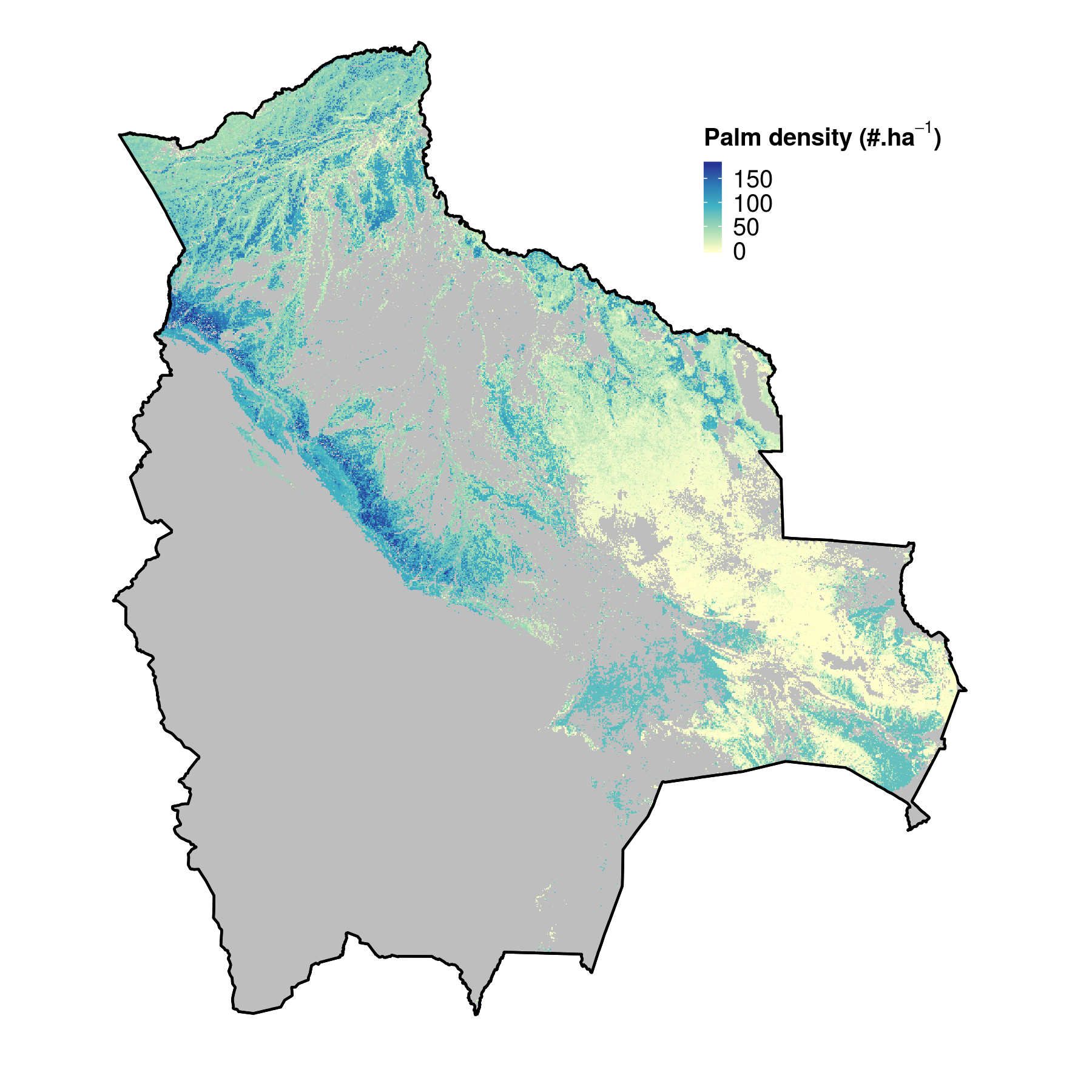 Density of Palm tree |
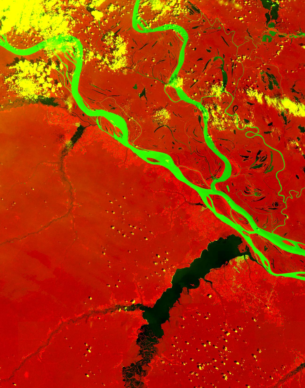
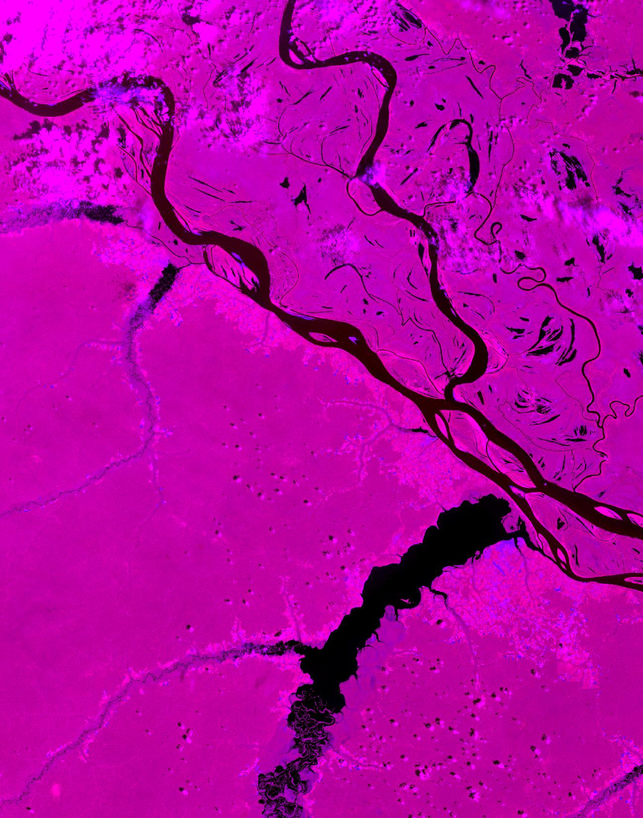
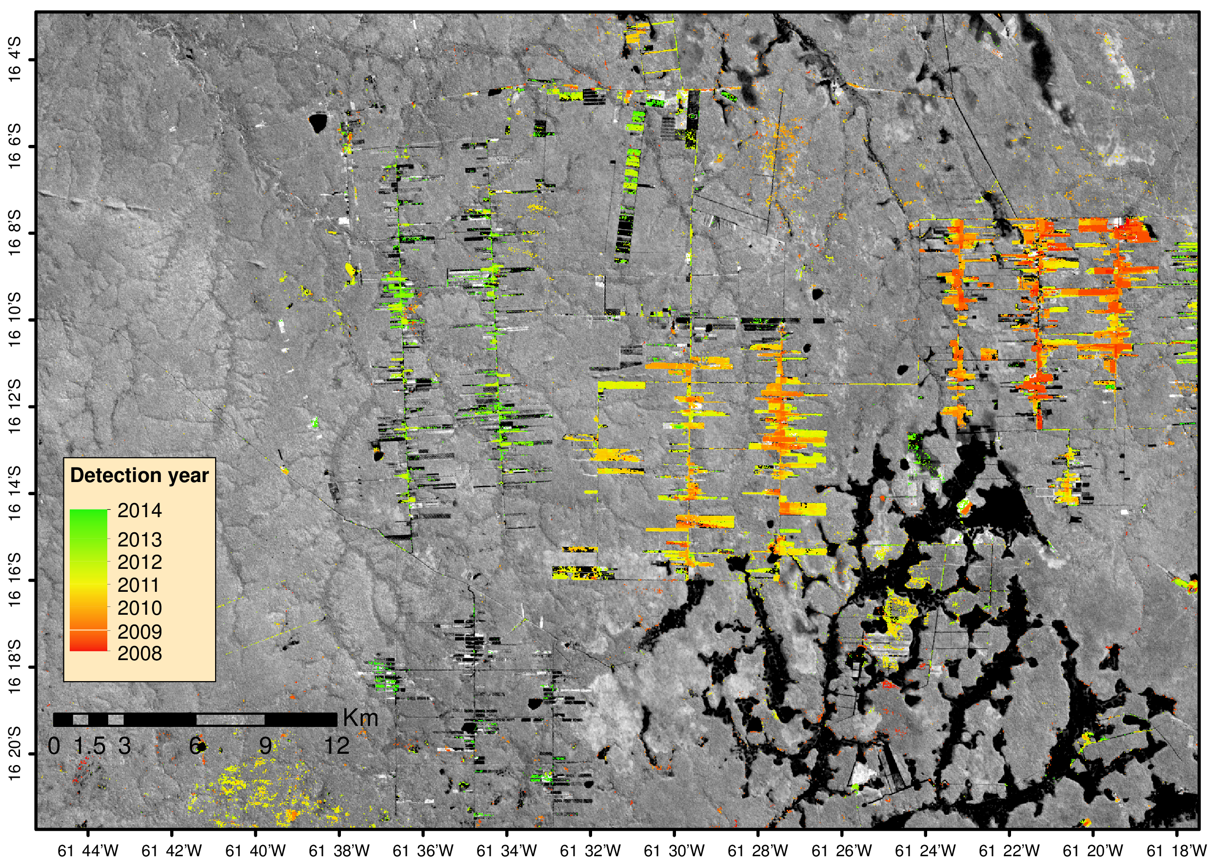
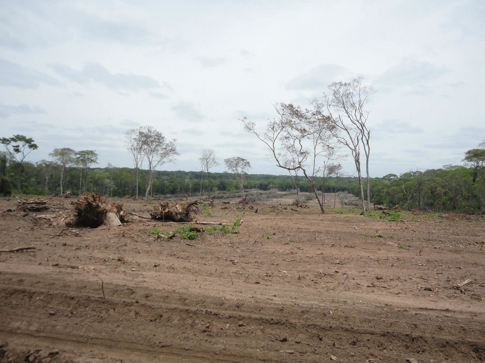
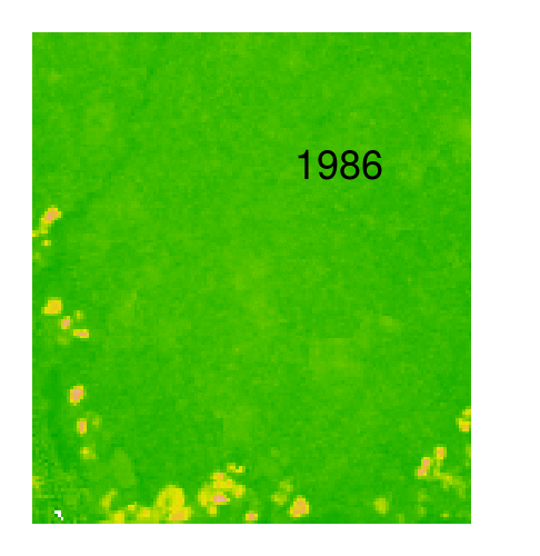
Chapter 2: Deforestation mapping
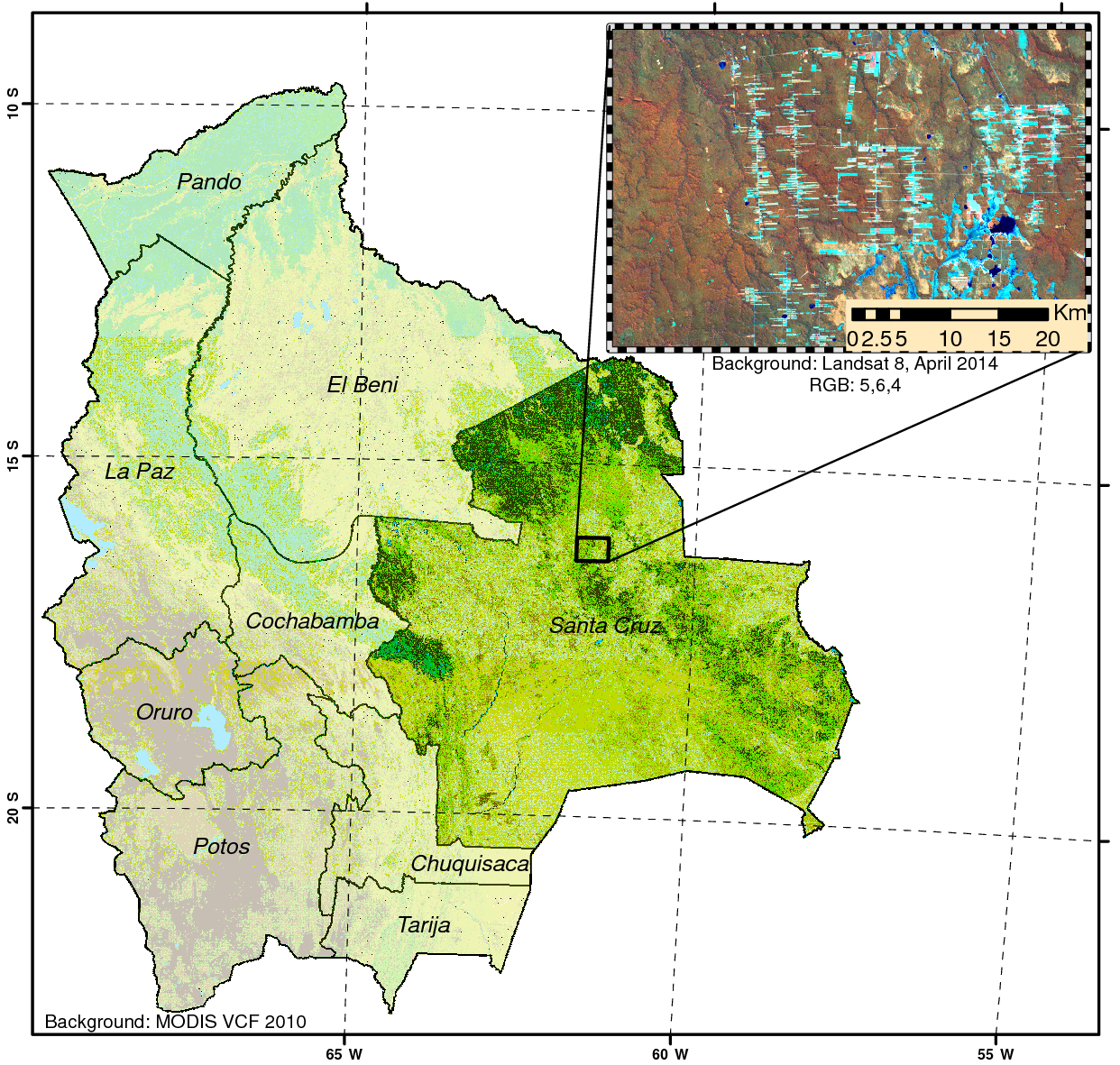
Chapter 2: Deforestation mapping
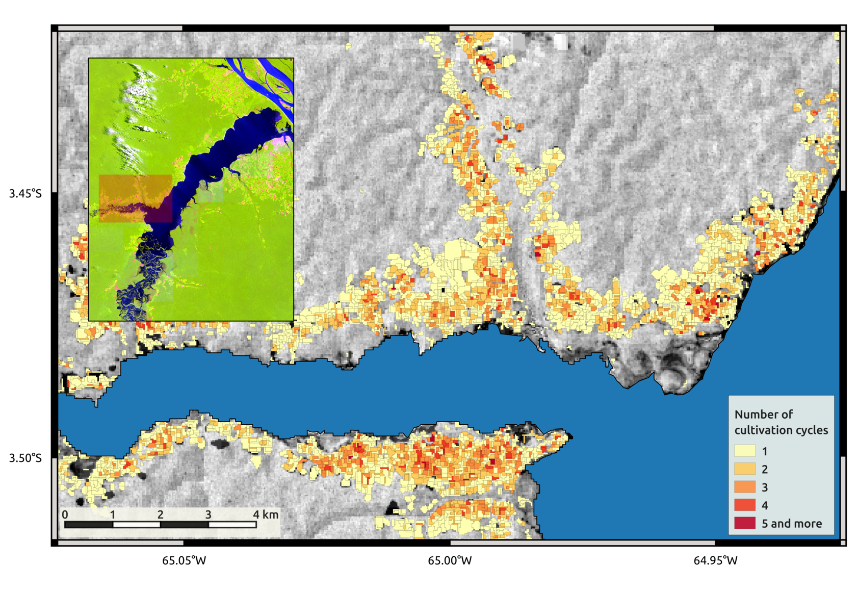
Chapter 3: Slash and burn agriculture
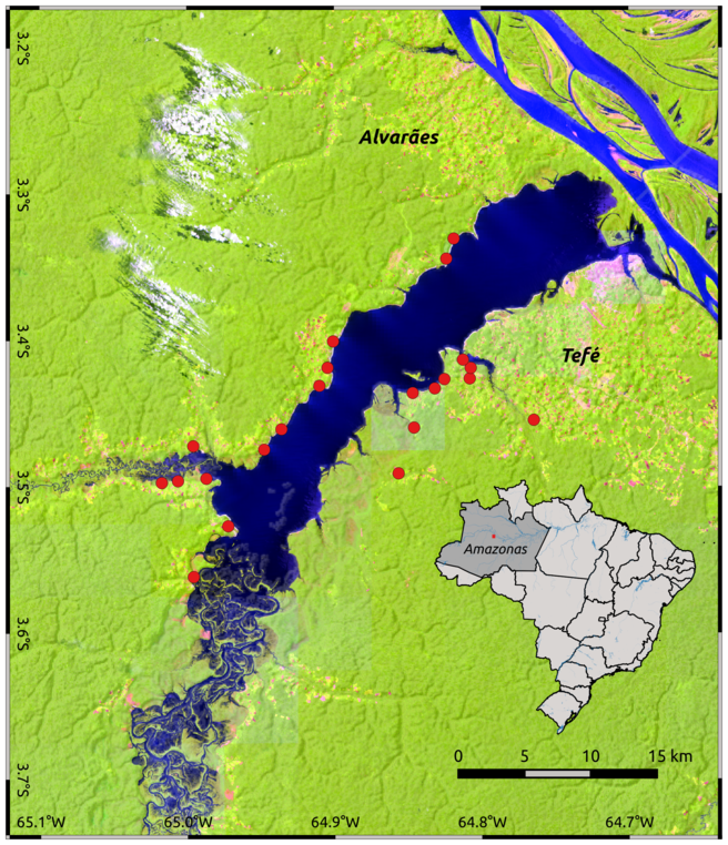
"Land use intensity in slash and burn agriculture systems strongly influences the capacity of the forests to regenerate"
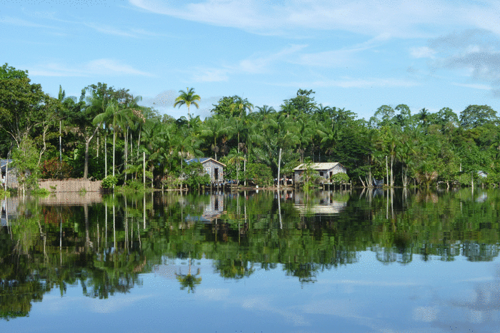
Chapter 3: Slash and burn agriculture
We "reconstructed" the land use history of the past 30 years
Chapter 3: Slash and burn agriculture
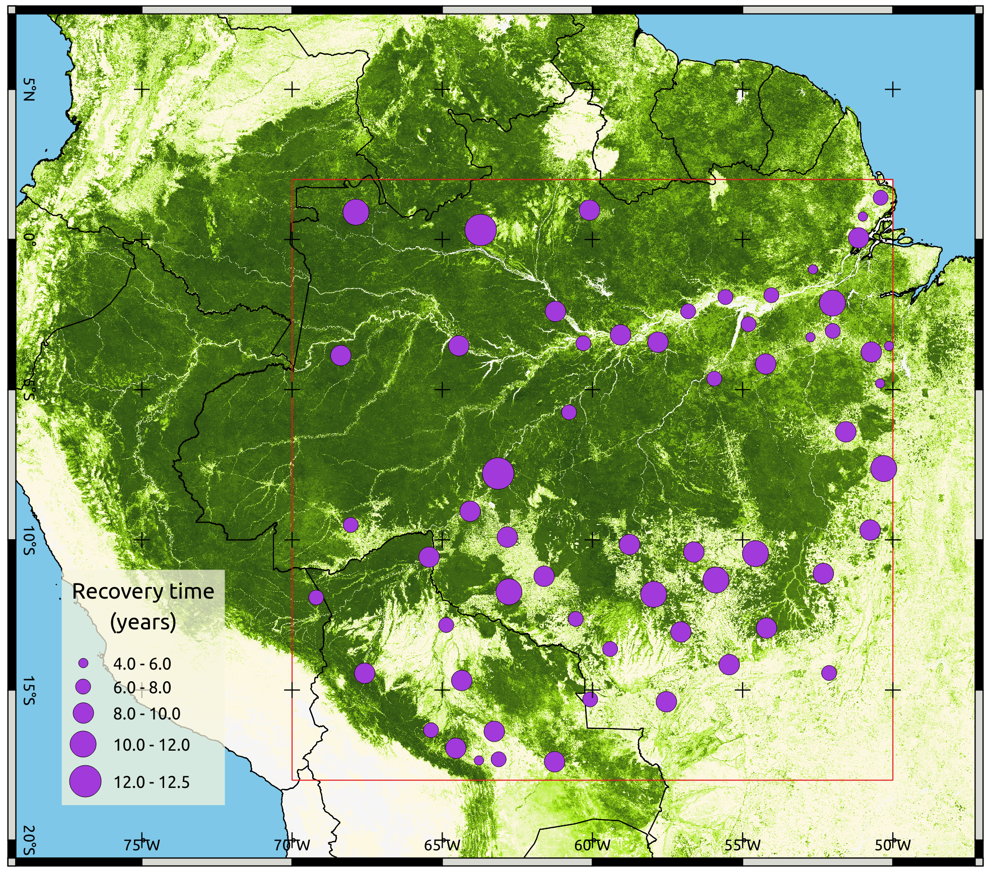
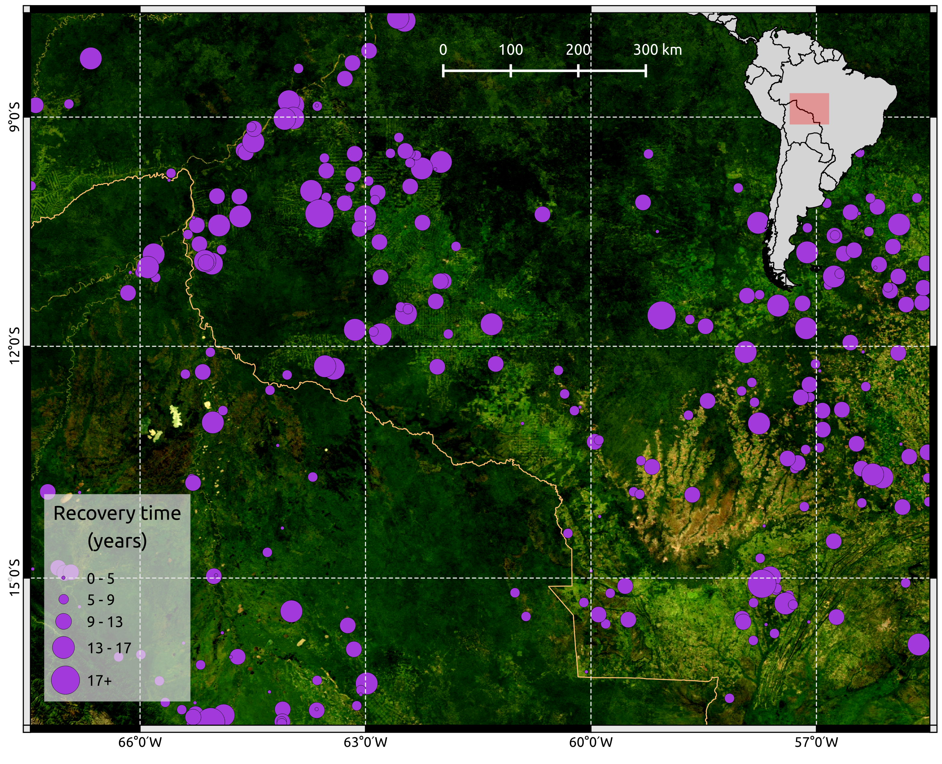
Chapter 4: How fast do forests recover?
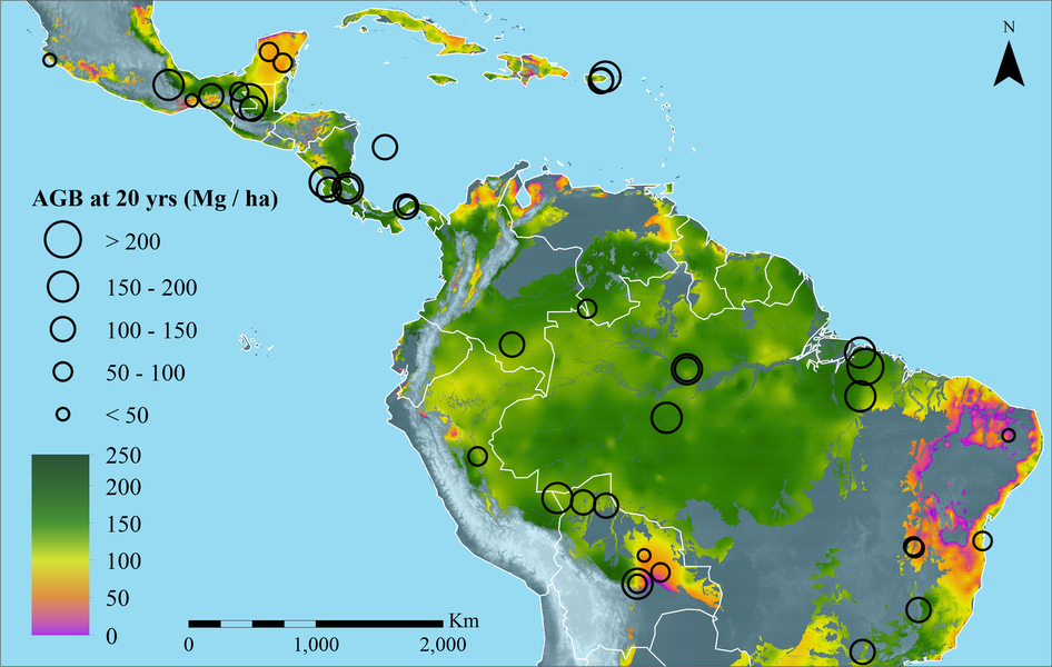
Can remote sensing help?
Chapter 4: How fast do forests recover?
Conclusion
Remote sensing has a big potential for monitoring forest resources and ecological processes
Conclusion
Taking advantage of all the remote sensing dimensions is required to better capture ecological processes
Thank you!
Multidimensional remote sensing based mapping of tropical forests and their dynamics
Loïc Dutrieux